Activity in the Pacific and What's Stirring in the Atlantic? - Tropical Update (August 16, 2015)8/16/2015  The 2015 Hurricane Season has reached it's turning point. What does it mean? It means that we're now in the most active period of the season, which is of course from August to October, in the Atlantic, the entire Atlantic Ocean in the Northern Hemisphere is what experts are watching for tropical development. And how's the Atlantic right now? 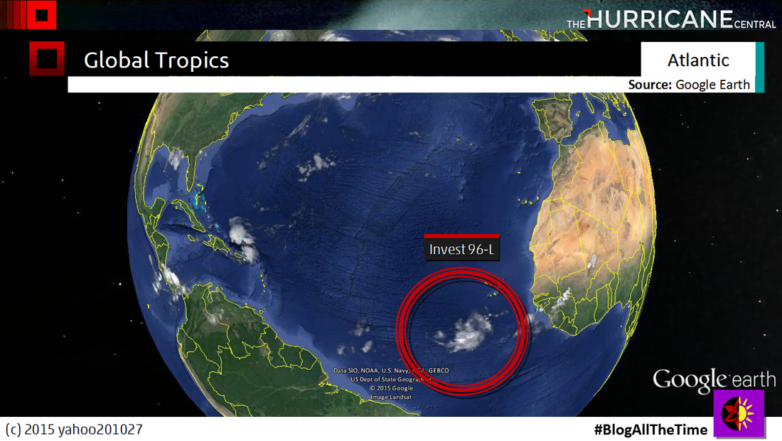 It's quiet in the open Atlantic except for the circled area. That is Invest 96-L coming out from Africa, just south of Cape Verde 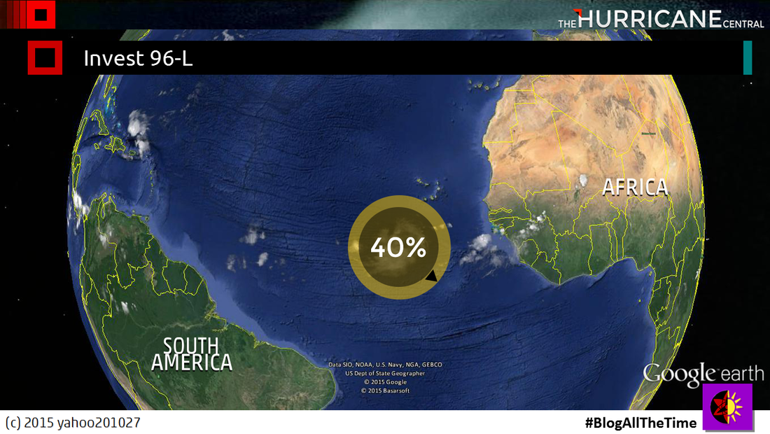 The National Hurricane Center gave this system a 40% to develop in the next 5 days, 30% in the next 2 days. Of course, it is that time we check over the Cape Verde area for development. Better known as the "Cape Verde Season". And if you look at the names for the Atlantic so far this year... 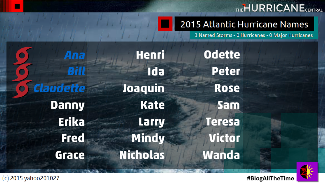 Only Three. Three names that has been used for the Atlantic Season. Of course, Ana was the earliest to form this season, before the season began, and made landfall in the Carolinas. Then Bill lashing Texas following weeks after the Memorial Day Flooding. And most recent, Claudette, a fish storm and made landfall as a remnant low in the Canadian Maritimes. Yeah. the season only had 3 Named Storms, with No Hurricanes. Will we see a season with no hurricanes? I mean, 2013 almost had it, but Humberto ruined the fun. However, the Pacific this season has stolen the spotlight, thanks to El Nino, triggering the Pacific to be a busy one. So far this season... 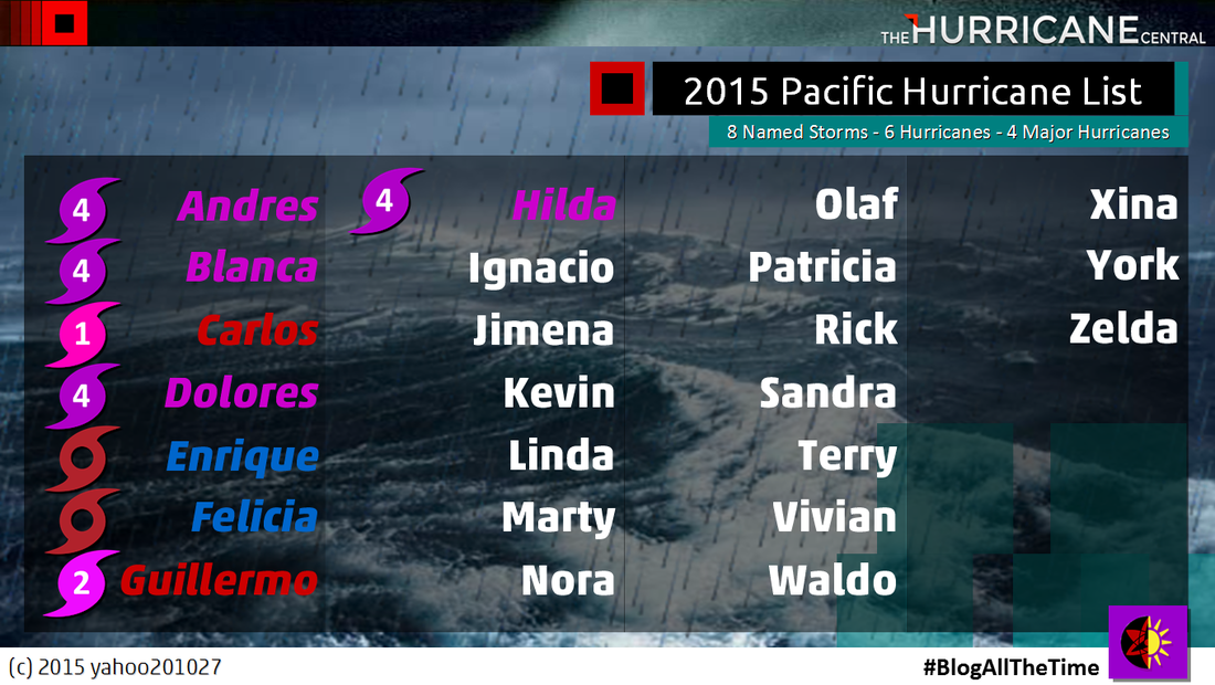 Eight Named Storms in the Eastern Pacific, with Three in the Central Pacific. And already, Hawaii felt threaten on almost getting hit by tropical system after tropical system. Hilda was the most recent name, next in the list is Ignacio. And will we see Ignacio is the next few days? No. 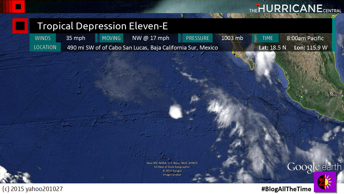 Tropical Depression Eleven-E has been formed earlier today, but because it has been formed by the tip of the Baja California Peninsula, it has no chance of upgrading into a Tropical Storm. Reason why is because it's by cooler waters, so that means it's gonna die rather quickly. 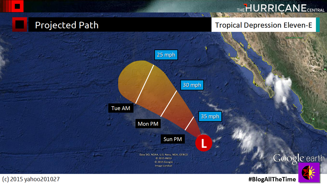 Projected Path shown that it's gonna head over cold waters, meaning that this system is short lived. No chance of seeing Ignacio in the next few days. But of course, it's the Western Pacific that is getting the most attention right because of two typhoons active in that region. 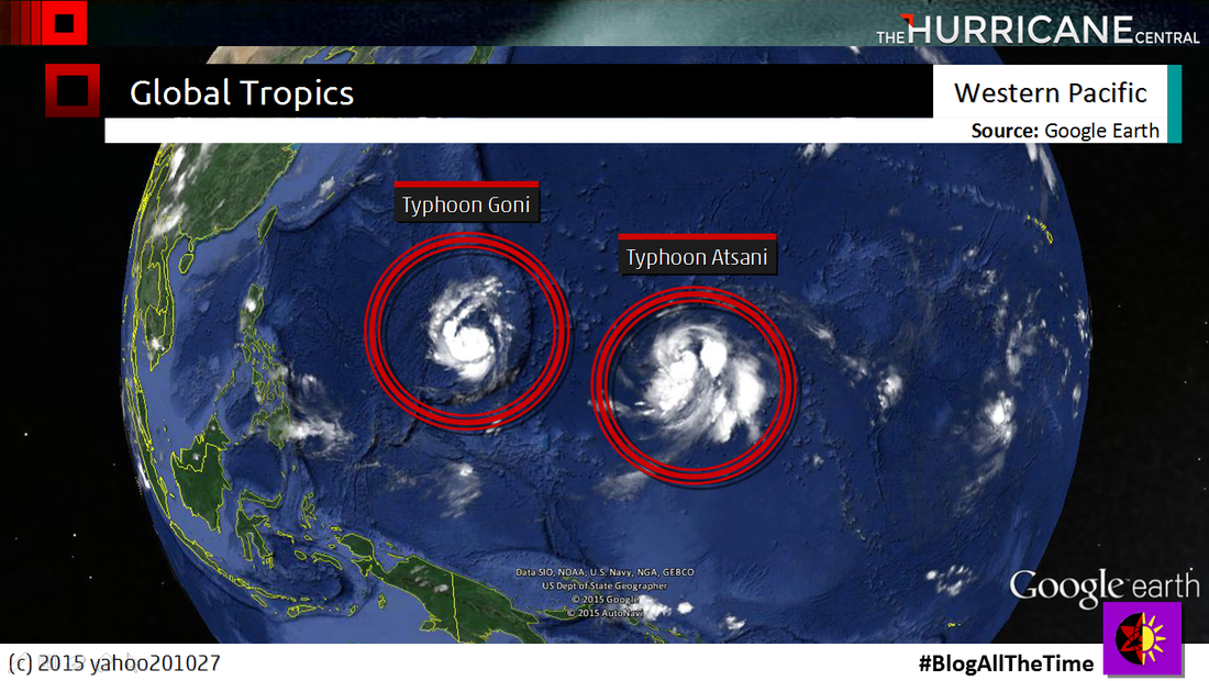 Typhoons Goni and Atsani, both the equivalents of Category 1 Hurricanes, been lashing Guam and Saipan, of course, Goni has done it's job, Atsani could have it's turn, but according to the Joint Typhoon Warning Center, it projected to move away from Guam and Saipan. Goni however, projected to be a strong typhoon, and expected to hit Taiwan in the next few days before hitting China. It's like Goni is following Soudelor's footsteps, except Goni is South of where Soudelor hit.
Comments
|
About this pageThis Page Contains the News and Information on this Hurricane Season Storm AgenciesClock*All Times Central
Andrea (Subtropical Storm)
Barry (C1 Hurricane) Chantal (Tropical Storm) Dorian (C5 Hurricane) Erin (Tropical Storm) Fernand (Tropical Storm) Gabrielle (Tropical Storm) Humberto (C3 Hurricane) Imelda (Tropical Storm) Jerry (C2 Hurricane) Karen (Tropical Storm) Lorenzo (Active) Melissa Nestor Olga Pablo Rebekah Sebastein Tayna Van Wendy 
Alvin (Cat. 1 Hurricane)
Barbara (Cat. 4 Hurricane) Cosme (Active) Dalila Erick Flossie Gil Henriette Ivo Juliette Kiko Lorena Mario Narda Octave Priscilla Raymond Sonia Tico Velma Wallis Xina York Zelda Archives
May 2017
|
 RSS Feed
